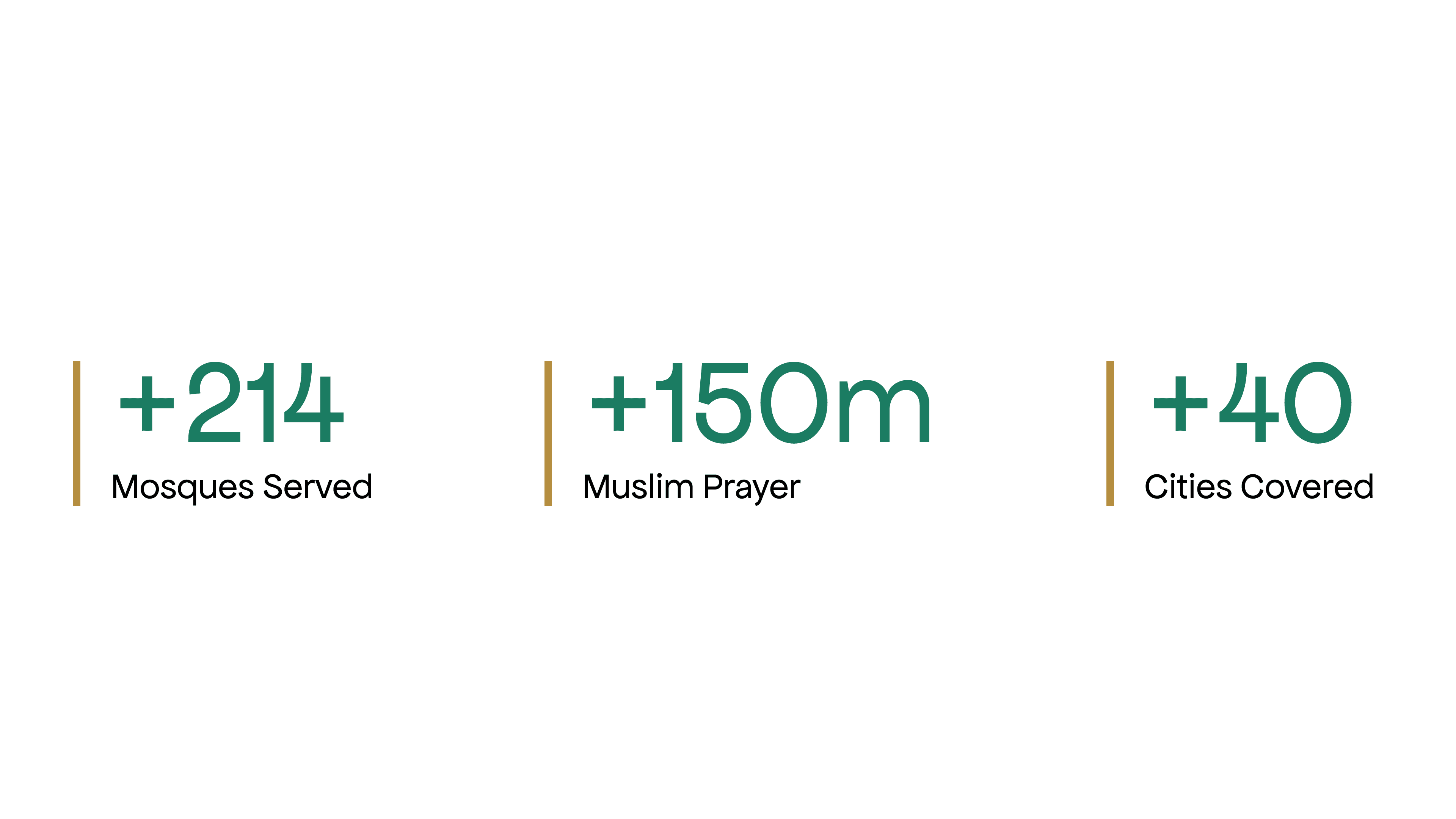

01
Overview
The Problem
Most users are driving, so they needed a non-distracting way to keep track of the road while easily seeing upcoming mosques along the route. Users also complained about how hard the app was to use while driving, and about the lack of information on places before reaching them.
The Goal
Create an interactive map and navigation with a smart way of displaying information. The new design keeps users focused on the road and gives them space to engage more with the application.
02
Solution
Our main purpose is to make life easier for travelers. In the previous version, users took a lot of time to navigate the route they wanted. In the new design, users choose their route much more easily: the closest route to the user's location is displayed as the first suggestion.
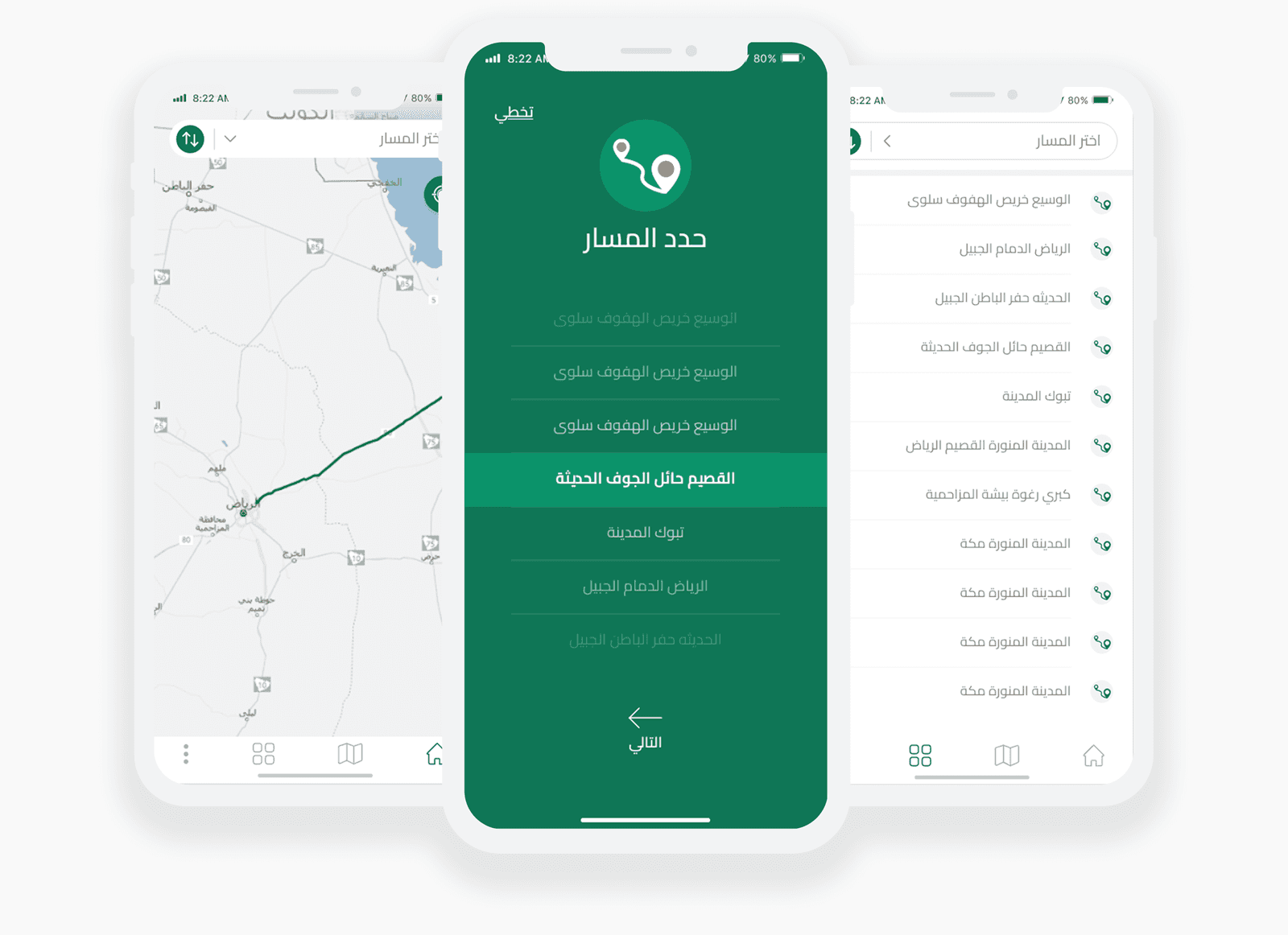
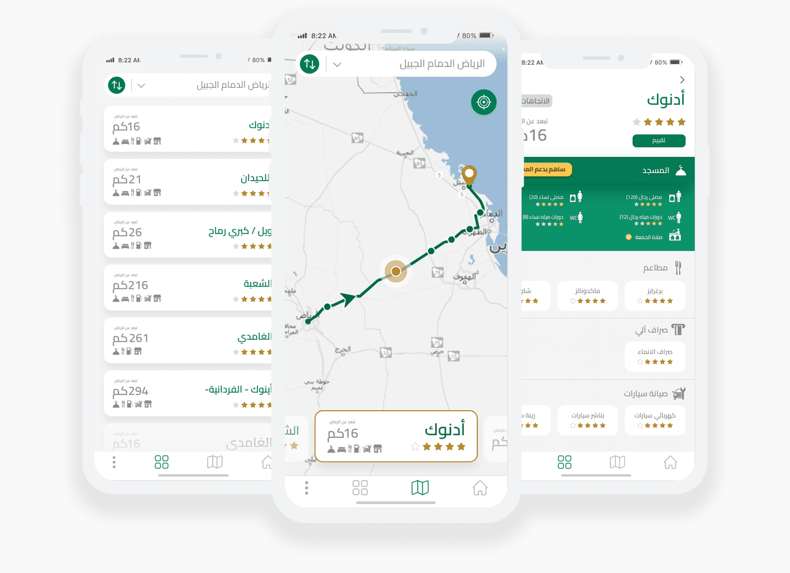
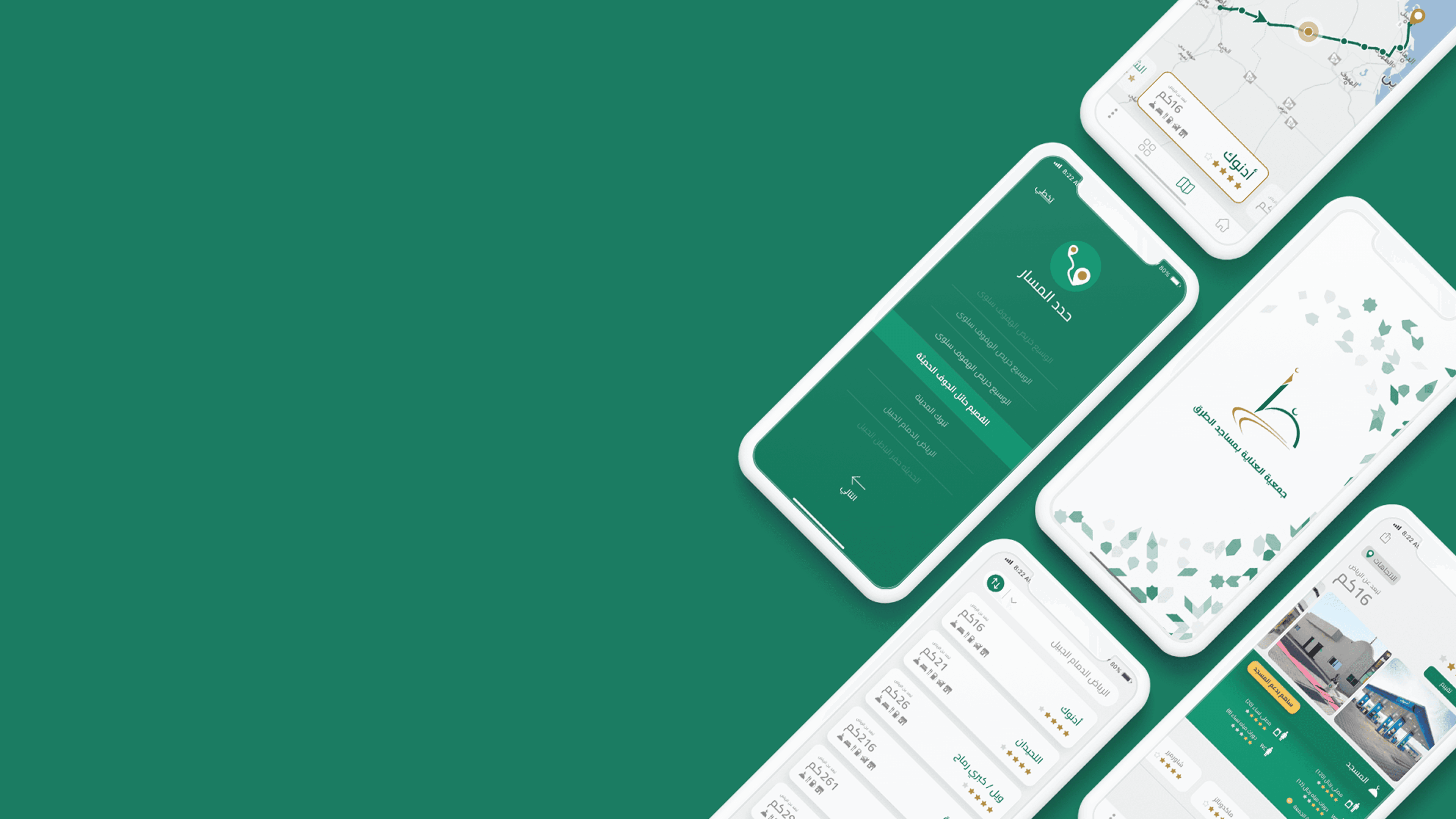
The new design gives the user a comfortable way to see the mosques on the road, a new card system is introduced in the design that displays the name of the next point in an obvious way, alongside the rate of the point and the most important features for each point, the new design also introduces the remaining distance to the point. The new design also introduced a very easy way to reverse the route in case a user wanted to change the route, and the design helps users to use the application with one hand use, we are not encouraging users to use phones during rides, but if users did, they don't need to use both hands.
The closest or coming point is highlighted and displayed in a clear way to users, so it can be emphasized enough to the route takers, and the next ones can be displayed in cards next or previous points, or a user can choose to display a list of all the points on the route.
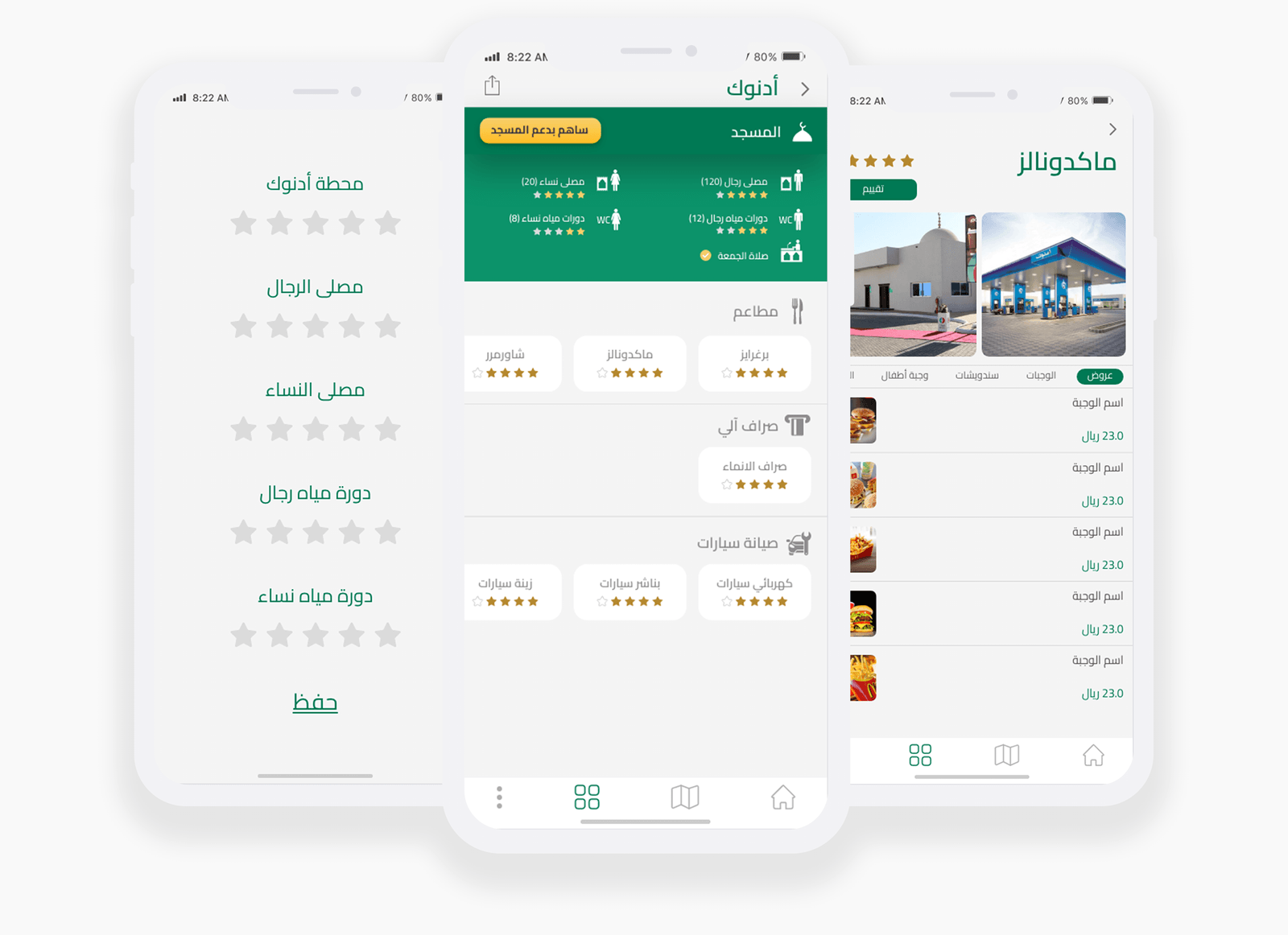
In the old design, users were not able to check the quality of the mosque and its facilities, with the need for information, users needed to learn more about the next stop, we conducted research to meet our users' need to find what are the most important things users needed in the first place. With the new design, users are able to share and recommend the points users liked, and users can check statistics and numbers about different facilities, these numbers are representing the capacity of mosques, Friday prayer, WC qualities, and availability of places for women to pray, also users are able to check ATMs and restaurants near any point.
Also, users can check promos and all the menus of the restaurants near a specific point or mosque, All these features are important for the supervision of the mosques and for the people who are responsible to offer the best quality for users of the road.
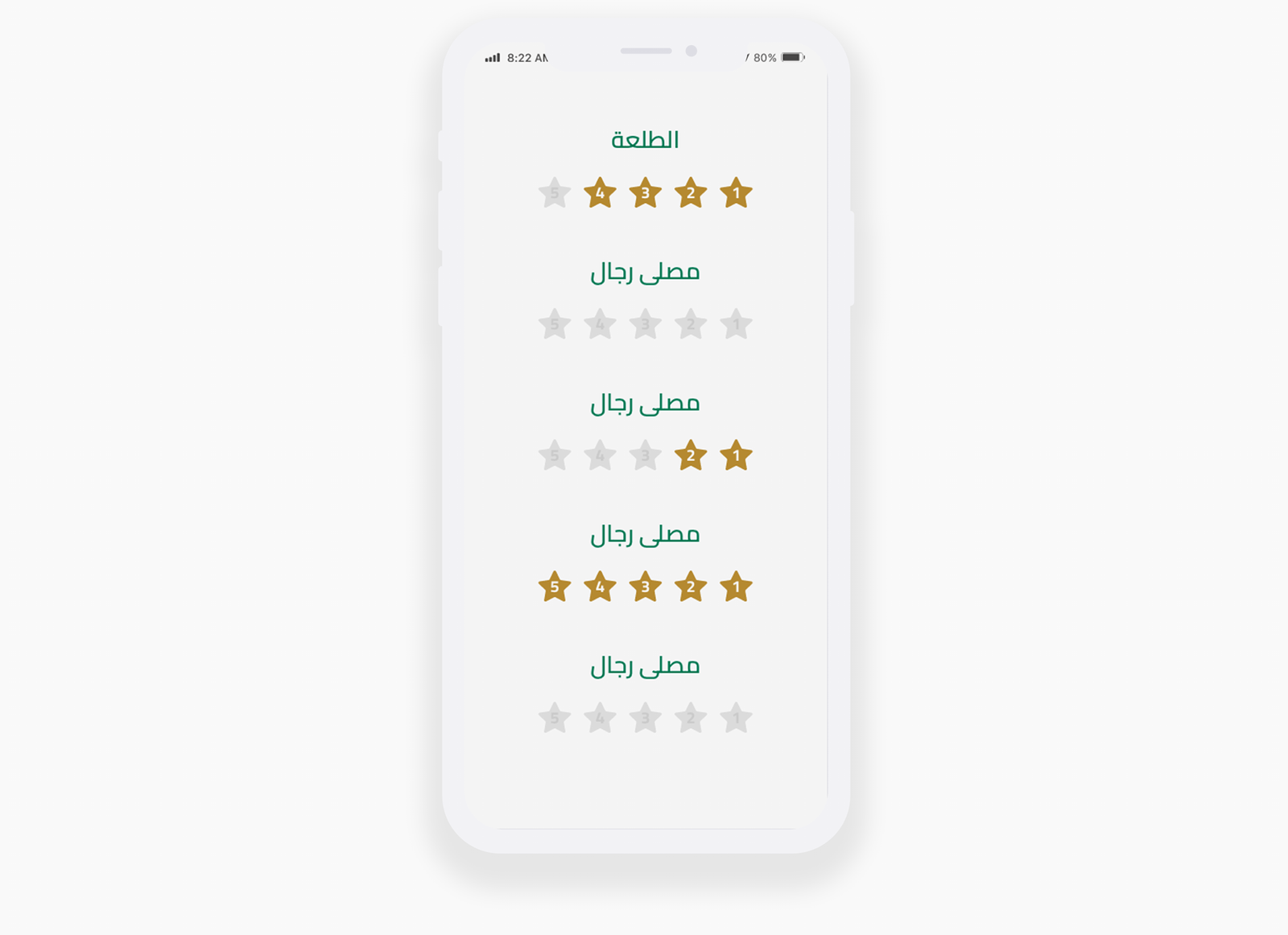
After launching the new design, users reported a struggle in determining the direction of the stars that represent the reviews, since the application language is Arabic, they were taking more time to guess the direction, and in most cases, users were giving the wrong or an undesired number of stars, in the next iteration, we added a number to work as signifiers for users.